- Children from Shijin Kindergarten Made a Study Trip to Shilin UGGp
- Have a spring date with Shilin flowers
- Call for hosts of the 12th International Conference on UNESCO Global Geoparks in 2027
- Call for applications: UNESCO Global Geopark Mentorship Exchange
- Representatives of Changshan Aspring UGGp Visited Shilin UGGp
- Shilin UGGp Visited Xingyi Aspiring UGGp
- Children from Peiqi Kindergarten Visited Shilin UNESCO Global Geopark
Lists of Geosites of the Shilin UGGp
Annex 3 List of geosites of Shilin UGGp
1.Classification of geosites in Shilin UGGp
Categories
Class
Code number
Geosites Name
Types
Significance
Utilization
Public
Interpretation
Of fundamental geology (2)
Rock profile
G1
Maoshuidong basalt profile
G
REG
ED/UD
G2
Qingshuitang basal conglomerate profile
G
REG
ED/UD
PI
Of geomorphology
Karst Landform (33)
G3
Major stone forest
G/C
INT
ED/T
PI
G4
Minor stone forest
G/C
INT
ED/T
PI
G5
Naigu stone forest
G
INT
ED/T
PI
G6
Lizi Yuanqing stone forest
G
INT
ED/T
PI
G7
Shangpucao stone forest
G
INT
ED/UD
PI
G8
Shuangjianshan-Mahuangtang stone forest
G
NAT
ED/UD
G9
Wannianlingzhi stone forest
G
NAT
ED/T
PI
G10
Gaoshitou stone forest
G
NAT
UD
G11
Xiannühu stone forest
G
NAT
ED/UD
G12
Leida Shi stone forest
G
NAT
ED/UD
PI
G13
Wangchengshan stone forest
G
REG
UD
G14
Shixiangzi stone forest
G
REG
UD
G15
Wenbishan stone forest
G/C
REG
ED/UD
G16
Suoyishan stone forest
G
REG
ED/UD
G17
Bushaoshan stone forest
G
REG
ED/T
PI
G18
Akaoyi stone forest
G
REG
UD
G19
Laohuangshan stone forest
G
REG
UD
G20
Pudoucun stone forest
G
REG
UD
G21
Laoguanshan stone forest
G
REG
UD
G22
Weiboyi stone forest
G
REG
UD
G23
Suogeyi stone forest
G
REG
UD
G24
Yingpan stone forest
G
REG
UD
G25
Qingshuitang stone forest
G
REG
ED
PI
G26
Songmaoshan stone forest
G
REG
ED/UD
PI
G27
Heishitou stone forest
G
REG
ED/UD
PI
G28
Sibeihou stone forest
G
REG
UD
G29
Majianshan stone forest
G
REG
UD
G30
Geyihei stone forest
G/C
REG
ED/UD
G31
Dushishan stone forest
G/C
REG
ED/UD
PI
G32
Daqingshan stone forest
G
REG
UD
G33
Hemo stone forest
G
REG
ED
PI
G34
Shima Longgong cave
G/N
NAT
ED
G35
Tianshengqiao natural bridge
G
REG
ED/UD
PI
Of water
(7)
Waterfall
G36
Youguxianpu waterfall
G
REG
UD
Spring
G37
Bailongtan spring
G
REG
ED/T
PI
Lake (Wetland)
(5)
G38
Changhu lake
G/N
REG
ED/T
PI
G39
Shidimari lake
G
REG
ED/UD
G40
Yuehu lake
G
REG
UD
G41
Yuanhu lake
G
REG
UD
PI
G42
Heilongtan reservoir
G/C
REG
ED/T
PI
Note: INT-international significant geosites; NAT-National significant geosites; REG-Regional significant geosites; G-Geosites; N-Natural (biological) heritage sites; C-Cultural heritage sites; ED- geosites used for education; T-geosites for tourism; UD-undeveloped geosites; PI-public interpretation.
(33)
2.Descriptions of geosites in Shilin UGGp
No.
Name
Description
Photo
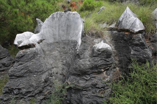
G1
Maoshuidong basalt profile
It features porphyritic, blocky, amygdaloidal basalts, with obvious multi-phase eruption rhythms; The Permian Maokou & Qixia Fm. limestone is covered by basalt residual layer with the maximum thickness of up to 200 meters; the maximum height of limestone karren (original stone forest) under basalt cover is up to 6 meters, thermal metamorphized edge is observed.
G2
Qingshuitang basal conglomerate profile
It is the fluvial-lacustrine semi-colluvial, denser, semi-hard brownish-red basal conglomerate, with conglomerate compositions of limestone, dolomite, and a few basalt, it is 1.7 m thick, and has a depositional rhythmites that recorded the dissolution and depositional processes of carbonate rocks in the past.
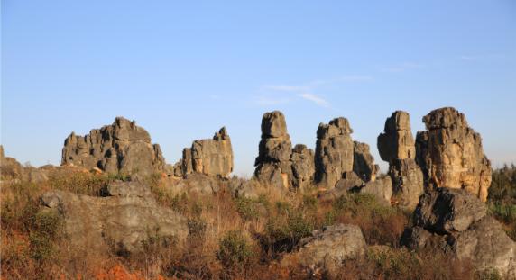
G3
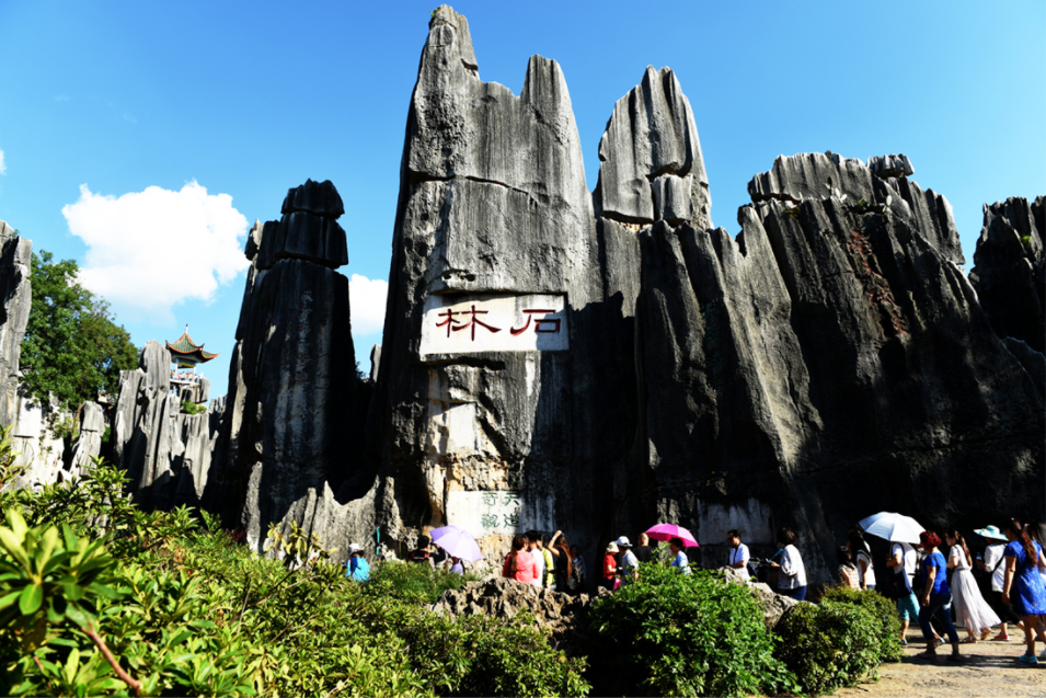
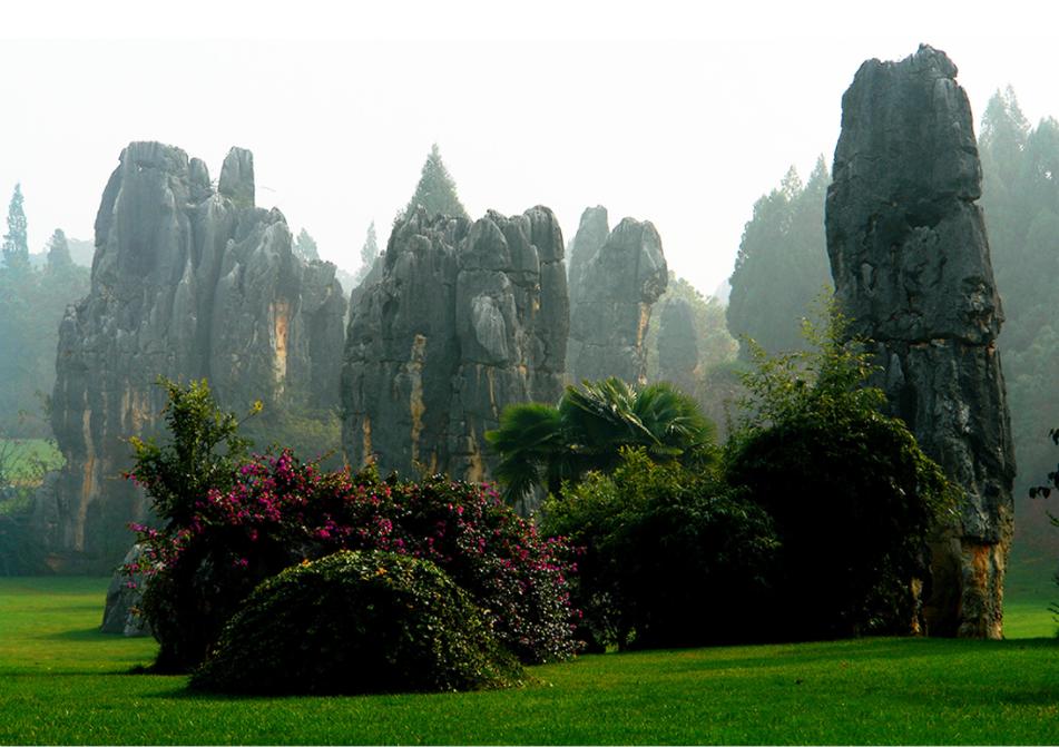
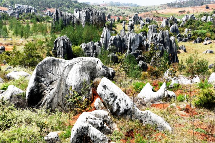
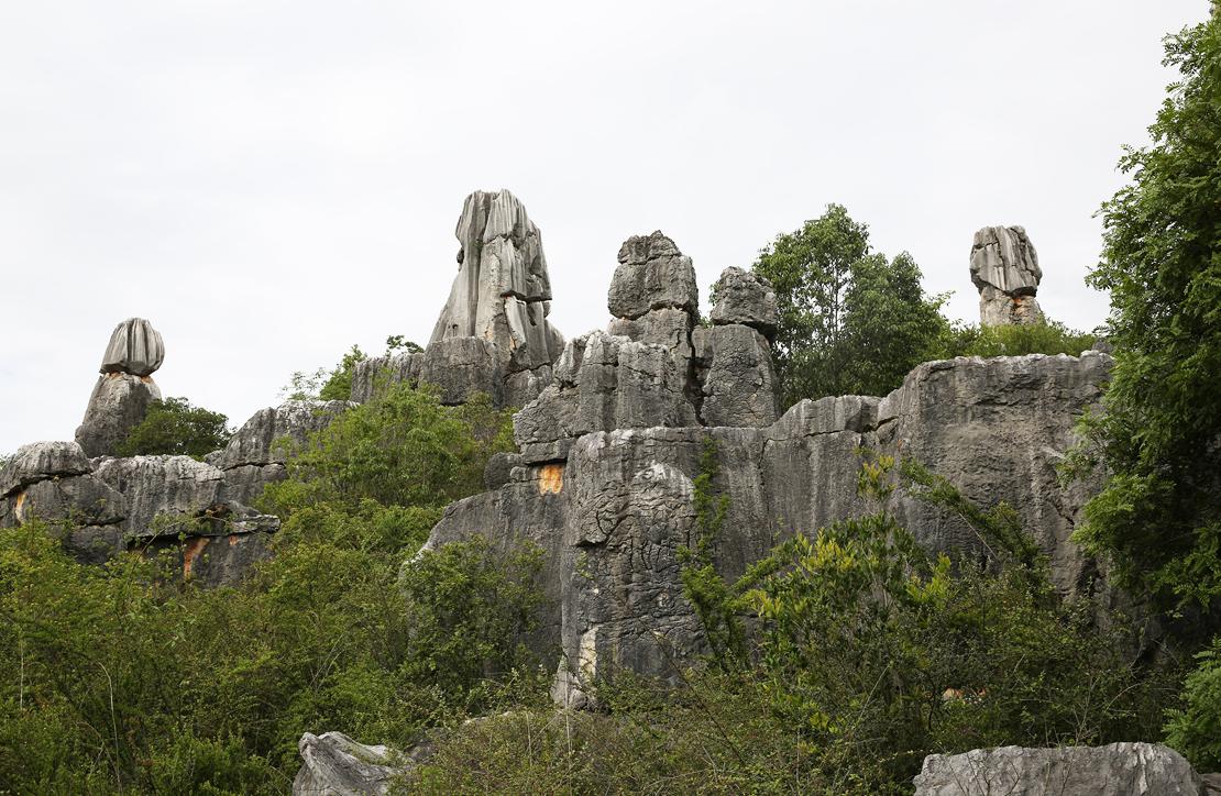
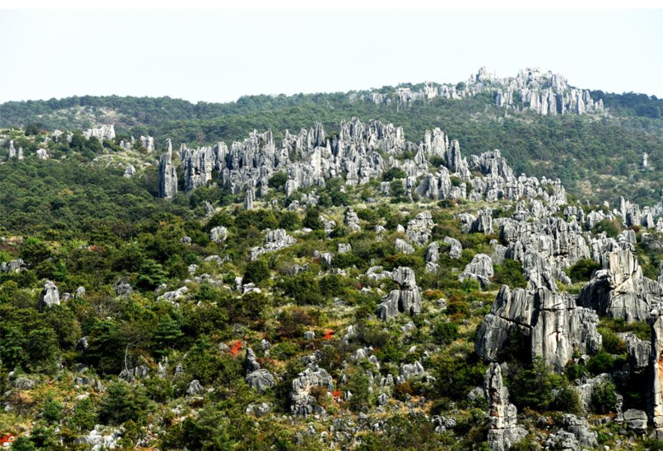
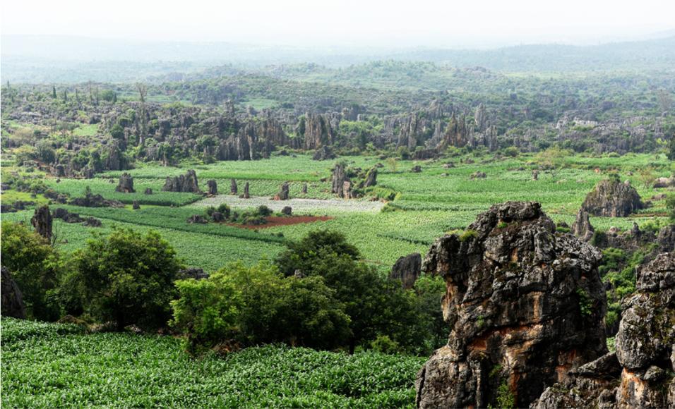
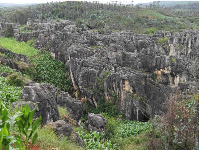
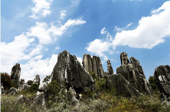
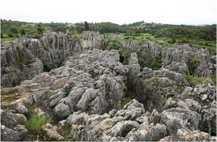
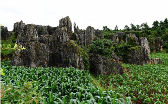
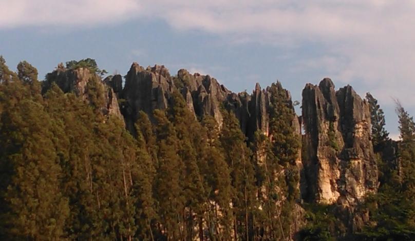
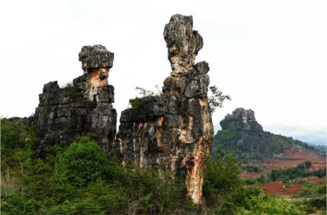
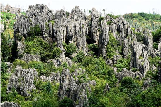
Major stone forest
Da Shilin (major stone forest in P1m limestone) has an area of 46.32 hectares and is located in a depression of the altitude of 1760- 1790m. The Da Shilin is a typical sword-like and columnar stone forest type. The stone pillars may be 40m above the ground and retain the barrel-shaped dissolving channel, subcutaneous notches, tubes.
G4
Minor stone forest
Xiao Shilin (Minor stone forest) covers 4.75 hectares. It develops in P1m limestones. The location is close to the Da Shilin, located at the bottom of the depression. The development and evolution are closely related to the Da Shilin. Individual pillars are popular here with few clustered pillars.
G5
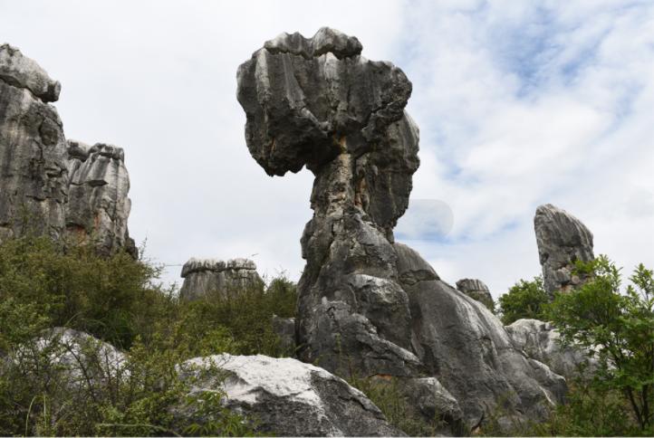
Naigu stone forest
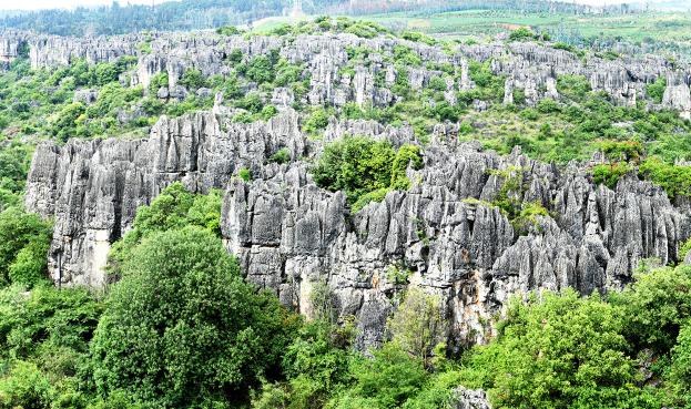
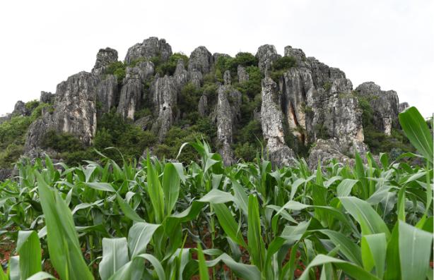
The Naigu Shilin covers an area of 185.68 hectares and develops in Permian Qixia thick limestone and dolomite. Stone Forest, caves, blind valleys, dry valley, hilly, karst depression etc. develops well. Stone forest is shaped in mushroom, screen-like, columnar, lotus-shaped, and irregular-shaped with a few meters to 25m high. Most stone pillars are attached to a basement. It can be divided into 8 stone castles. Each of them has some isolated stone pillars in its peripheral area.
G6
Lizi Yuanqing stone forest
The Lizi Yuanqing Stone Forest has an area of 19.33 hectares, develops in Permian Maokou Fm. limestone and in a closed depression, and belongs to the ex-basalt stage stone forest. At the ridge and depression edge, stone forest is shaped in sword, columnar and irregular. The height of them is of a few meters to 20m.
G7
Shangpucao stone forest
Shangpucao Stone Forest occupies an area of 21.11 hectares, develops in Permian Maokou Fm. limestone at ridges of hill and hillside, with 1900m to 2000m asl. It is close to the edge of Lunan ancient lake basin, the stone forest once was covered by Paleogene lacustrine deposits and reemergence after eroded away. The dissolution along bedding planes makes the shapes of rock pillars tower-like or columnar, with a height from several meters to 15m.
G8
Shuangjianshan-Mahuangtang
stone forest
Shuangjian Shan-Mahuang Tang Stone Forest develops in the Permian Maokou Fm. limestone and dolomite, P2c basalt, with an area of 310.71 hectares. Main types of stone forest developed in Quaternary period along the depression (valley), slopes and ridges. Stone pillar is typical with a height of 5-20 meters. Shuangjian Shan is a residual bimodal basalt hills, which occupies an area of 4.48 hectares. This area can be divided into two parts, not only there is a significant difference in shape in the south and in the north, but also in rock relieves on stone pillars.
G9
Wannian Lingzhi stone forest
The Wannian Lingzhi stone forest occupies an area of 66.77 hectares. The strata are Permian Maokou Fm. limestone with the dip of less than 5°, and scattered Emeishan basalt strata. The stone pillar is shaped big in upper part and small in lower part just like a Ganoderma. There are patches of mushroom-like, tower-like stone pinnacles, 5-15m high, surrounding the hill ridges, there is basalt residual cover remains.
G10
Gaoshitou
stone forest
Gao Shitou area covers 13.81 hectares. It develops in the Permian Maokou Fm. limestone with the dip of 5-10° and rich in fossils. Sword-like stone forest and columnar stone forest distribute along the ridges of hills. The stone columns in this area are of a few meters to 20 meters high.
G11
Xiannühu stone forest
Xiannü develops in Permian Maokou Fm. limestone with an area of 42.94 hectares. The stone forest is shaped in sword, lotus, tower, mushroom, columnar, short pillars and so on. The height is of 10m to 15m, to 21m extremely. North of the Xiannü Hu lake, conglomerate of Paleogene Lunan Fm. covers ancient stone teeth. Xiannü lake is a small solution lake, about 164m length, 80m width, and with a water area of about 0.9 hectares.
G12
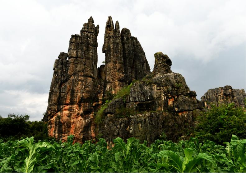
Leidashi
stone forest
Leida Shi has an altitude of 1780-1810m and an area of 71.26 hectares. It develops in the Permian Maokou Fm. limestone, and is rich in fossils. The columnar stone forest along the hillsides can be divided into five concentrated parts. The stone pillar area is of a few meters to 20 meters high, and shows multi-development stages. Such as the former basalt stone forest, Lunan ancient Lake Stone Forest, plateau Ba Jiang Valley stone forest.
G13
Wangchengshan
stone forest
The Wangcheng Shan stone forest covers an area of 140.14 hectares. The terrain is open undulating as mainly the karst hill, depressions and valley distributes. Mainly P1m limestone; Stone Forest and stone teeth distribute in clusters on hilltop or slope, and the stone teeth field distributes around troughs and depressions. It mainly demonstrates different periods of Stone Forest, displaying the stone forest "generation".
G14
Shixiangzi
stone forest
Shixiangzi stone forest is mainly of open undulating terrain with karst hill, depressions and troughs with an area of 32.57 hectares. Mainly P1m limestone, Stone Forest and teeth distributes in clusters on hilltop, troughs and depressions, which mainly demonstrates different periods of stone forest development.
G15
Wenbishan
stone forest
Wenbi Shan stone forest develops in the P1m and P1q limestone, dolomitic limestone and dolomite and Permian P2c basalt with an area of 185.42 hectares. It is mainly formed as weathered basalt cover, erosion residual peaks, slopes and ridge stone forest development. The basalt cover reflects this stone forest is formed before.
G16
Suoyishan
stone forest
Covering an area of 11.43 hectares, the Suoyi Shan is karst hill forest, develops in the D2q bioclastic limestone and dolomite. The individual stone pillar is predominant, which is shaped as sword-shaped, columnar, short columnar, etc. around castle-shaped stone forest with the height of 10-25m. Inside the castle-shaped stone forest, individual pillar developed with a height of 3-10m. On top of stone are various typical rainwater erosion trenches.
G17
Bushaoshan
stone forest
The Bushao Shan, 12.47 hectares, develops in Permian Maokou limestone. The stone Forest develops in a residual karst hill on the eastern edge of depression, at which Da Shilin Stone Forest is developed. The elevation of peak of hill is 1796.7m, and sword-shaped and columnar stone forest is developed in this area. Among them, sword-shaped pillars distribute at top of hill, 2-6 meters high.
G18
Akaoyi stone forest
The Akaoyi Stone Forest covers 11.19 hectares, with an elevation of 1780- 1 820m, develops in Permian Maokou Fm. limestone. And the tower-shaped and mushroom-shaped stone forest, develop along the ridges with a height of 2-8m. The stone pillars are higher at the lower ridge than the one at the higher ridge. Between of them is developed stone teeth filed. On the surface of stone pillars, there are karren and notches subcutaneous and rain dissolution features.
G19
Laohuangshan
stone forest
Laohuang Shan covers 20.55 hectares, develops in Carboniferous Maping Fm. limestone, Permian Qixia Fm. black thick-bedded limestone and dolomite, Permian Liangshan shale, quartz sandstone. Castle-shaped stone forest and columnar stone forest develop along the ridges, hillsides and depressions. The stone pillars in this area are of a few meters to 20 meters high. The stone forest formed in plateau Ba Jiang Valley stage developed on the base of the stone forest formed in ex-basalt stage. On the top of the stone pillars.
G20
Pudoucun stone forest
Pudoucun Stone Forest occupies an area of 42.09 hectares, 1820m to 1840m asl. The stone forest develops in top and ridges of hill, hillside, even in depressions, formed in upper segment of Permian Qixia Fm. (P1q) and lower segment of Maokou Fm. (P1m) dolomitic limestone and limestone. The shapes of stone columns are diversity and are predominated by columnar, mushroom-like, lotus-like and irregular, with a height from several meters to 15m.
G21
Laoguanshan
stone forest
The Laoguan Shan stone forest covers 11.31 hectares, altitude 1 830-1890 m, is developed in the Permian strata Maokou Fm. limestone, Lunan ancient lake period, and is rich in fossils. The columnar stone is preponderant. On the body of stone, there are well dissolved troughs, horizontal dissolved troughs and dissolved holes developed.
G22
Weiboyi stone forest
The Weiboyi Stone Forest covers an area of 51.69 hectares. It is located in the northern of Weiboyi Village at elevation of 1850- 1970m above sea level. Along the hillsides and karst hill, there are two patches of stone forests developed. It is formed in Permian Qixia Fm. thick black limestone and dolomite. The stone pillars, mostly with common basement and poorly separated, appears as short tower-like and columnar stone forest, with the height of 3-8 meters. The karren are well developed at top of stone pillars.
G23
Suogeyi stone forest
Suogeyi Stone Forest occupies an area of 39.77 hectares with the elevation of 1880-1950m. It develops in Permian Maokou Fm. limestone, Qixia Fm. dolomitic limestone and dolomite. Stone pillars distributes at top of hills, or at hillsides and depressions. The stone pillars are columnar and short columnar with a range a few meters to 10 meters in high. Two levels of subcutaneous notches or channels, caverns are obvious at different height of pillars from hillside to depression.
G24
Yingpan stone forest
Yingpan Stone Forest, developed in the Permian Qixia Fm. dolomitic limestone and dolomite at the peak and ridges of karst hills, covers an area of 6.68 hectares, and even along karst depressions. The shapes of stone pillars are of columnar, mushroom, lotus and irregular, with height of several meters to 10 meters. There are varies dissolution rills, well-like channel developed on the pillars.
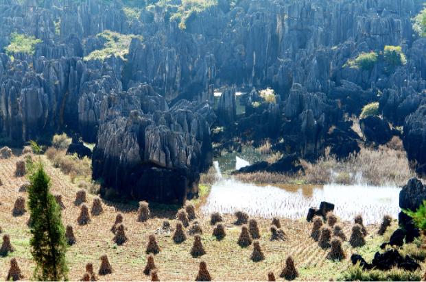
G25
Qingshuitang stone forest
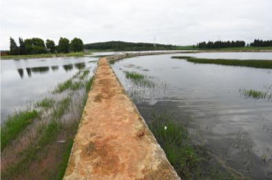
With an area of 64.23 hectares, the stone forest develops in Permian Maokou limestone and Paleogene Lumeiyi Fm. clastic rocks. Along lake basin, depression and slope, the stone forest develops in shapes of sword, lotus, tower, mushroom, columnar, short columnar, with the height from 10 to 15m. There are varies dissolution rills, well-like channel developed on the pillar surface. Due to the barrier of impermeable layer of Lumeiyi Fm. it formed the Qingshuitang wetland.
G26
Songmaoshan
stone forest
Songmao Shan covers 4.5 hectares, developed in Permian Maokou Fm. limestone, Emeishan basalt and Neogene sand and conglomerate. It is a typical site for presenting multi-phase development of stone forest: the stone forest of late Permian, the stone forest of Neogene period and the stone forest of Quaternary. The stone pillars are scattered with a height less than 7m. The stone teeth were slightly metamorphized by late Permian basalt.
G27
Heishitou
stone forest
Hei Shitou Stone Forest developed in Permian Qixia Fm. and Maokou Fm. carbonate rocks and occupies an area of 9.85 hectares at the elevation from 1880m to 1935m. The gentle hillside stone forest develops well and the shapes of stone columns are given priority to columnar and mushroom-like. The residual subcutaneous notches and tubes are well preserved. Some traces of groundwater conduit are observed.
G28
Sibeihou stone forest
The stone forest occupies an area of 3.68 hectares in 1870m to 1897m above the sea level. It developed in the Permian Maokou Fm. limestone at the peak of hill and along karst valley with sword-like and columnar pillars, and covered or half covered stone teeth. Paleogene Lunan Fm. basal conglomerate covers on the ancient stone teeth or fills in lowlands between stone forest pillars. The height of stone column is several meters to 30 meters, with varies karren on pillars.
G29
Majianshan
stone forest
With an area of 83.07 hectares, Majian Shan Stone Forest develops in Permian Maokou Fm. limestone on the top and ridges of the hill, hillside and even in depressions. The shapes of stone pillars are dominated by columnar, mushroom, lotus-like and irregular shapes with the height from several meters to more than 10 meters. In the lowland, stone pillars appear as isolated columns in the crop fields.
G30
Geyihei stone forest
With an area of 585.02 hectares, the stone forest develops mainly in Permian Qixia Fm. dolomitic limestone, dolomite rock, C3m and D2q limestones. Several meters to 10 meters high columnar pillars and Stone teeth develop in karst basin. There are at least two levels of subcutaneous notches or tubes existed on the pillars at different heights from highland to lowland.
G31
Dushishan
stone forest
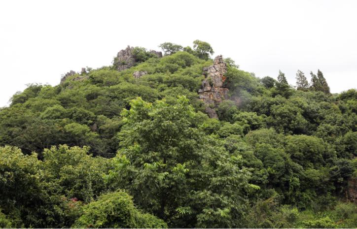
Dushi Shan is an individual hill, consisting of Permian Qixia Fm. and Maokou Fm. carbonate rocks, with an area of 2.46 hectares. The elevation ranges from 1900m to 2000m above sea level. At the peak of hill or along hillside, the columnar rock pillars develop, 4m to 8m in height. It is a historical site protection unit of county level.
G32
Daqingshan
stone forest
Daqing Shan Stone Forest covers an area of 16.33 hectares with elevation from 1800 to 1820m. The stone forest develops in Permian Maokou Fm. limestone along karst hill and hillsides of Daqing Shan hill. The shapes of stone columns are dominant with sword-like and columnar. Dissolving features are well developed at stone pillars.
G33
Hemo stone forest
The stone forest developed in Permian Qixia Fm. dolomitic limestone and dolomite; Maokou Fm. limestone covers an area of 77.62 hectares at the range of elevation from 1880m to 1932m above sea level. The stone forest distributes in depressions, karst hills and hillside, in the shapes of mushroom-like, columnar, castle-like and sword-like, with several meters to 20 meters high.
G34
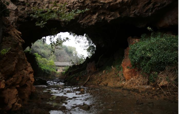
Shima Longgong cave
Shima Longgong cave is located at a depression 200m west of Wei Bo Yi Village, and formed in P1q and P1m carbonate rocks, with 1230m long and 102m deep, the elevation of entrance is 1880m asl. its bottom is connected with the Weiboyi underground water system, flowing from Wei Bo Yi Village to Heilongtan reservoir. The cave passage extends in E-W direction, with average width of about 56m, cave floor is piled up collapsed rocks.
G35
Tianshengqiao natural bridge
The natural bridge is located at Tian Sheng Qiao Village, and formed in Permian Maokou Fm. limestone. The Natural Bridge is 19.1m in height, 50.2m in length and 28. 5m in width. The maximum thickness of bridge body is 8m, enough for cars. It forms by roof collapsed of upstream and downstream groundwater cave.
G36
Yougu Xianpu waterfall
Yougu Xianpu is located in a gorge northwest of Naigu Stone Forest, also named as Zhan Tun Waterfall. When water flows from Cambrian ∈1c to ∈1q rocks, due to the difference of lithology and cutting of fault, the waterfall is formed, with a fall of 57m.
G37
Bailongtan karst spring
It is the outlet of Shuitangpu-Bailongtan underground river, formed by the convergence of three underground river tributaries, with a total length of 12 kilometers, a source elevation of 1880 meters and an outlet elevation of 1710 meters, the underground river is buried at a depth of 15-20 meters, and the spring flow is stable, with a maximum flow rate of 1,264 L/sec and a minimum flow rate of 133.2 L/sec. The underground river develops karst windows and doline along the river path.
G38
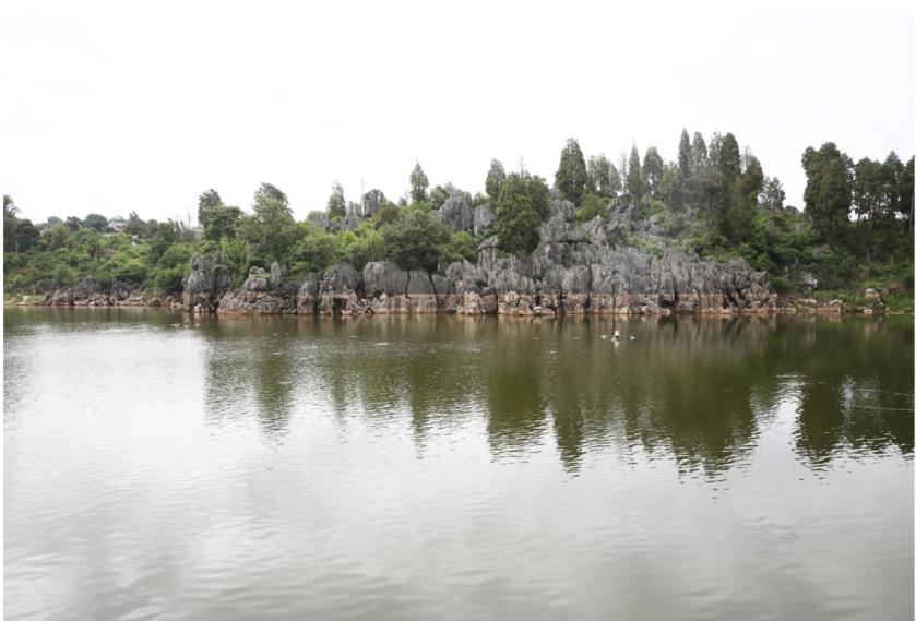
Changhu lake
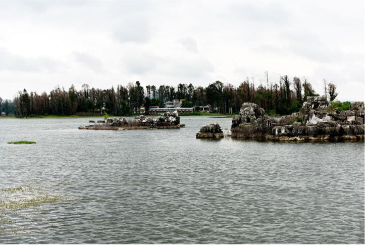
Chang Hu covers an area of 142.19 hectares. The basement of lake is consisted of Carboniferous C3m limestone and Devonian D2q shale and limestones. The Lake is long extending from east to west, about 1300m from east to west, 800m width from north to south, the average depth of 8m, and with a water area of 54 hectares. The lake is a typical tectonic dissolution lake, water level is 1900m above sea level, and is recharged by groundwater.
G39
Shizidimari lake
Shizidimari lake is consisting of two karst lakes, which is occupied an area of 153.18 hectares. They develop in Devonian Qujing Fm. limestone, Carboniferous Datang Fm. limestone and Baizuo Fm. bioclastic limestones. Due to shallow groundwater level, and influences of multi-strip fractures jointed at those areas, two groups of karst lakes are formed. Along beaches of lakes and hillsides, there are stone teeth.
G40
Yuehu lake
Moon Lake is a typical tectonic-corrosion lake, with a potential water area of 119.99 hectares. The bed of lake is consisting of Devonian shale rock. The stone forest if any is mostly residual at top of karst hill, and there are half covered or covered stone teeth developed.
G41
Yuanhu lake
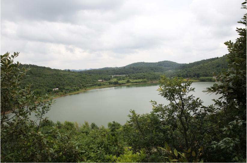
Yuan Hu Lake, located at south of Chang Hu geosite, is a typical karst doline full of water (lake) with 16.11 hectares water area, surrounding by karstic mountains and hills. It is mainly recharged by groundwater. The name, Yuan Hu (Lake) comes from its shape.
G42
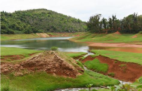
Heilongtan artificial lake
The reservoir occupied an area of 136.31 hectares built in Permian Maokou Fm. limestone and Paleogene Lumeiyi Fm. sandstone gravels. It is recharged by karst underground river systems. Surrounding the reservoir, the stone forest distributes at the ridges of hills, along hillsides, also some covered or half covered stone teeth remains. It is the main source of water supply.